
Chase-cam for Paragliding with Google Earth
System requirements :
- Google Earth Pro 7.3.3 or later
- GPX file (with altitude and min 1[Hz] position recording)

How to make a funny chase-cam video for paragliding with Google Earth ?
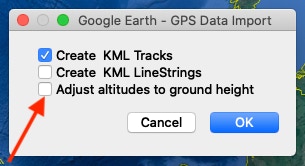
1) Open/Import GPX file : Don’t forget to uncheck « Adjust altitudes to ground height », else Google Earth uses only 2D coordinates with a projection on his own altitude profile (based on ground height).
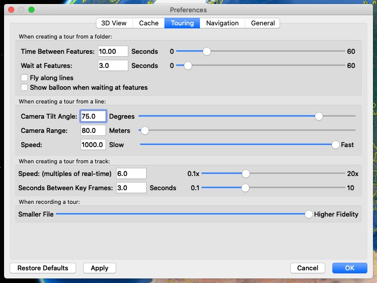
2) Adjust settings : These settings are used in above video. Remark : « Camera Tilt Angle » is measured from vertical axis.
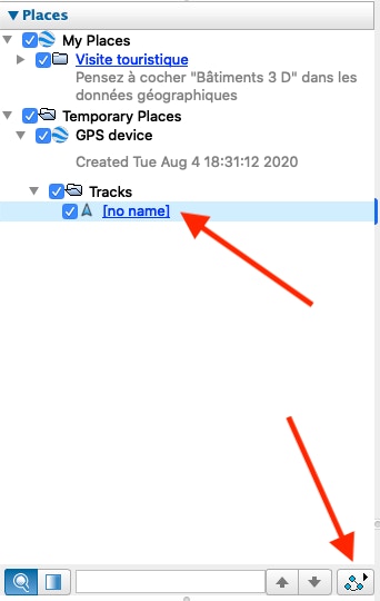
3) Create and save a tour : by following these three steps.
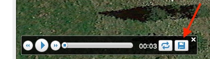
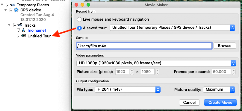
4) Create and export a video : by opening « Movie Maker » in « Tools » menu.
© 2020…2026 MultiDimensions™, Julien Geissbühler